


What it is
Davis Islands is a neighborhood on two islands just south of downtown, at the mouth of the Hillsborough River. The City of Tampa says it was created in the 1920s by developer and Tampa native D.P. Davis, from two small natural islands called Little Grassy Key and Big Grassy Key, and that the land was built up from mud dredged from the bottom of Tampa Bay. It is technically an archipelago: a canal fully separates part of the neighborhood from the rest. There were originally three islands, but when the airport was built the end of one canal was filled in to make a runway, which joined the two largest islands at their southern ends and left two.
Davis and his islands
Wikipedia says Davis planned a resort community with three hotels, a nine-hole golf course, an airport and a swimming pool. A Florida history site says all 300 prepared lots sold on opening day, October 4, 1924. The boom did not last. By 1926, according to the Davis Islands Civic Association's history, Davis was expecting about four million dollars in second payments on Davis Islands property and received only $30,000. Tampa Electric's owners, Stone & Webster, formed a subsidiary that bought Davis Islands on August 2, 1926. Davis himself was lost at sea during a transatlantic voyage that October, and accounts of what happened differ. Wikipedia says development stalled when the land boom ended and the mix of building styles today reflects the slowdown of the 1930s.
Buildings and streets
Much of what Davis planned was built, and most of it still stands. The civic association's history says the exceptions are the golf course, the original tennis club and the Davis Islands Coliseum, which opened in 1925 and burned in the mid-1970s. The business district centers on the Bay Isle Building at 238 East Davis Boulevard, designed by Tampa architect M. Leo Elliott and completed in 1925. East Davis Boulevard is still the commercial street, with restaurants, cafes and shops along a few sidewalk blocks. The houses were built to the design rules of Davis's own company, in Mediterranean Revival, Italianate and Spanish styles with soft pastel colors and tile work. The Mirasol, the tallest building on the islands, stands at the end of a canal with its own yacht basin. The civic association also singles out the Palace of Florence, which has a tower at each end of its front.
Parks, the hospital and the airport
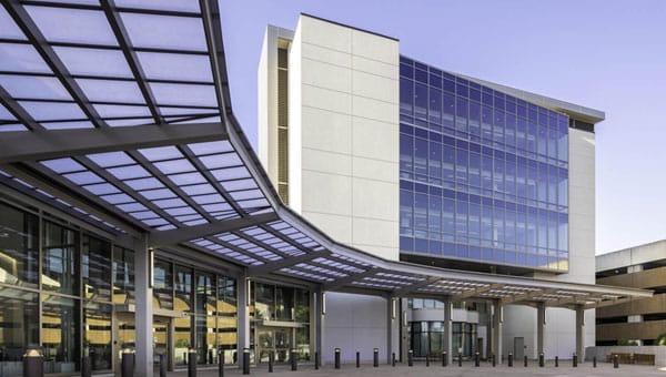
The city's page lists what shares the islands: Peter O. Knight Airport, the Davis Islands Yacht Club, Tampa General Hospital, the Sandra Freedman Tennis Complex and the Roy Jenkins aquatic center. Marjorie Park and its municipal yacht basin are on the islands too. The city says the park was donated to Tampa and that Davis named it for his wife, Marjorie Merritt Davis. Wikipedia says the Davis Islands Trail, a 10-foot-wide asphalt path completed in 2010, runs 1.3 miles from Channel Drive and Davis Boulevard to the airport parking lot. Tampa General sits at the northern tip and is the area's largest referral center and a Level I trauma center. Wikipedia also notes that it stands in what is designated an A flood zone and has been evacuated for hurricanes and rising water, which is worth remembering on a neighborhood built from dredged fill.
Sources: Davis Islands (City of Tampa neighborhoods); Davis Islands (Wikipedia, CC BY-SA); Davis' Plans Leave Lasting Impression (Davis Islands Civic Association); Continuing Story of D. P. Davis - Davis Loses His Islands (Davis Islands Civic Association); Davis Islands (Florida History Internet Center / Florida Historical Society)